
 English
 Español
 Deutsch
 日本語
日本語 Polska
 Français
 中國
中國 한국의
한국의 Українська
 Italiano
 Nederlands
 Türkçe
 Português
 Bahasa Indonesia
 Русский
 हिंदी
हिंदीArkansas Topographic Map STL Models Modelo de impresión 3D


- Formatos disponibles: Stereolithography: stl 450.86 MB
- Colección:No
- Anchura en milímetros:221
- Altura en milímetros:1.1
- Profundidad en milímetros:188
- Listo para Imprimir:No
- 3D Scan:No
- Para adultos:No
- PBR:No
- AI Capacitación:No
- Vistas:1684
- Fecha: 2022-06-15
- ID de artículo:402079
- Valoración:
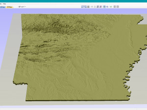
Create Detailed Arkansas Terrain Models with This High-Resolution 3D STL
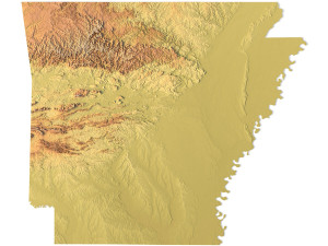
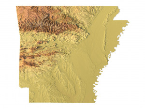
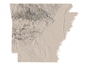
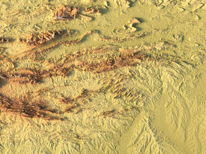
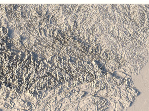
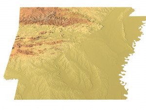
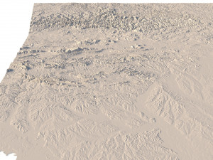
The Arkansas Topographic Map STL model provides a high-resolution representation of the state’s topography and geographic features. Perfect for creating physical relief maps from wood, metal, plastic, or concrete, this 3D model offers detailed accuracy for a variety of uses, including landform visualization, education, and professional GIS projects. Whether you’re using a 3D printer, CNC machine, or laser engraver, this model ensures precise terrain representation.
• Format: STL
• Files size: 867 MB / 450 MB
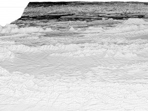
• Polygons: 18 188 670
• Vertices: 9 104 309
• Geometry: Polygonal Tris only
• Model size: 221.34 mm x 188.58 mm x 1.124 mm
• Distance between two neighboring vertices: ~ 0,06 mm
• Projection: Mercator
• Scaling factor X:Y:Z: 1:1:3
• Base: Open / Closed
Features of the Arkansas Topographic STL Model
• Detailed elevation data capturing Arkansas’ diverse landforms.
• Compatible with FDM/SLA 3D printers for creating accurate terrain models.
• Designed for CNC machining to craft wood or metal relief maps.
• Supports high-precision laser engraving for metal surface detailing.
Si precisa un formato distinto, por favor, abra una consulta de Soporte y solicítelo. Podemos convertir modelos 3D a: .stl, .c4d, .obj, .fbx, .ma/.mb, .3ds, .3dm, .dxf/.dwg, .max. .blend, .skp, .glb. Nosotros no convertimos escenas 3d y formatos como .step, .iges, .stp, .sldprt.!
Descargar Arkansas Topographic Map STL Models Modelo de impresión 3D stl De sychev23021983
arkansas state usa map landscape terrain country relief geography continent mountain earth stlArtículos relacionados De Arkansas Topographic Map STL Models


